SERVICE 03 / EXISTING CONDITIONS & SCAN-TO-BIM

From Existing Conditions to Reliable Digital Models.

From Existing Conditions to Reliable Digital Models.

From Existing Conditions to Reliable Digital Models.

Capture. Model. Coordinate.

Capture. Model. Coordinate.

We help project teams turn existing building information into accurate, organized digital documentation.

We help project teams turn existing building information into accurate, organized digital documentation.

We help project teams turn existing building information into accurate, organized digital documentation.

DISCUSS YOUR PROJECT →

SERVICE SCOPE

BIM documentation support using available site information and scan data. No surveying, architectural or engineering services are implied.

THE PROBLEM

You Can’t Plan Around Missing Information.

You Can’t Plan Around Missing Information.

You Can’t Plan Around Missing Information.

Old drawing with red annotations

Incomplete Drawings

Existing documentation doesn’t always reflect what’s built.

Tablet showing annotated site photograph

Uncertain Conditions

Missing dimensions and site information create coordination challenges.

Wood framing BIM duct and joist clash with red notes

Time-Consuming Rework

Unreliable information leads to additional verification and revisions.

OUR WORKFLOW

From Reality to a Usable Digital Model.

From Reality to a Usable Digital Model.

From Reality to a Usable Digital Model.

Explore each stage: capture available information, translate it into a structured model, then coordinate it for continued project use.

01 / CAPTURE

02 / MODEL

03 / COORDINATE

Loading point cloud…ORBIT + ZOOM

Capture

RS BUILD models from scans supplied by clients or independent subcontractors; scanning is not performed in-house. Based in Sudbury, Ontario, we can help arrange a scanning provider, depending on your project’s location and availability.

Point clouds provide a detailed 3D reference that can be revisited during modelling, helping reduce missed dimensions and repeat visits compared with tape measurements and handwritten notes. Results depend on scan quality and coverage; critical dimensions may still need on-site verification.

Compare the starting point with the digital model.

Compare the starting point with the digital model.

Tap or click between the two states. This is a conceptual placeholder until final project imagery is approved.

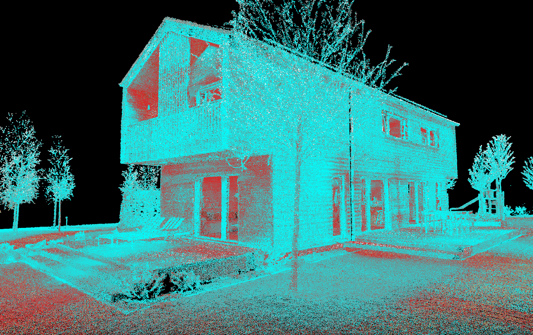
From point cloud to BIM

Drag the divider to compare the scan reference with the Revit model.

Perspective view of the Revit BIM house with timber siding, balconies and upper-floor windowsPoint cloud scan reference of the same house and surrounding siteBEFORE / POINT CLOUDAFTER / REVIT MODEL
Slide to reveal · Use ← → keys

DELIVERABLES

What Your Team Receives.

What Your Team Receives.

What Your Team Receives.

EXISTING BUILDING?

Working With an Existing Building?

Working With an Existing Building?

Working With an Existing Building?

Let’s turn your available site information into a clearer starting point for your project.

LET’S TALK ABOUT YOUR PROJECT →